December is off to a very chilly start. High temperatures have been 5 to 10 degrees below average every day. And each morning has been at or below freezing in Central Park.
But for those of you who prefer warmer winter days, be patient. Your time is coming!


Climatologically, average afternoon temperatures should be in the upper 40s this time of year. Morning lows should fall in the upper 30s. The first week of December this year has felt more like January.

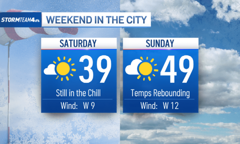
But warmer weather is on the way – and you’ll notice it this weekend. Temperatures through Saturday will remain well below normal, but a warm front will bring a surge of seasonable air into the region on Sunday, bringing our temperatures back to normal.
It won’t be warm by summertime standards, but it’ll certainly feel warm compared to this past week.

The warm front will slide through late Saturday night. It could spark some light snow showers in the cold air ahead of it – well to the north and west of New York City.
Accumulations will be under an inch, but if you live in the Catskills, Poconos or Capital District, it’ll be enough to freshen up your current snowpack so that you wake up Sunday morning to a sparkly white landscape.

Enjoy the snow while it lasts, because Sunday marks a several-day stretch of warm winter weather. The snow will be gone quickly, especially with rain in the forecast, too.

The warm weather will last for most of the coming week, with our best rain chances coming between Monday and Wednesday. Light rain is likely Monday. A few sprinkles or scattered showers are possible Tuesday.
Wednesday looks like the wettest day of the week, with steadier, heavier rain ahead of a cold front.

In total, we expect to get 1 to 2 inches of rain area-wide. It’s much-needed rain to help offset our ongoing drought.

Our current rain deficit since September is still well over half a foot, so we need much more rain than what we will get next week to erase the drought.

Next week’s rain will come to an end Wednesday night, when our next cold front moves through and drops our temperatures back below normal into next weekend.

Source link


